As we work ever so slowly towards getting some active transportation infrastructure here in St. John’s and around the province (or trying to prevent roads being built over what does exist), I retweeted this tweet with the comment “My dream is that somebody would be posting this about *our* NL!”:
“Before I moved to NL I knew they cycled a lot but I didn’t realise how much. It’s part of everything! And it’s amazing. I can’t begin to tell you how much having an integrated network of cycle paths improves your quality of life.”
Of course, the original tweeter was referring to the Netherlands, not Newfoundland and Labrador, and I immediately got a response that “it won’t ever happen because you can’t ride a bicycle up steep hills and you can’t get downtown and back without numerous steep hills. No hills in the Netherlands.” A couple of cyclists came to my defence and I replied myself as well, that I am 66 years old and I cycle up and down those hills. I’m aware that not everybody can, but many people can and want to. Why do car drivers have the right to go wherever they want but not people using active transportation? Also west-east routes are almost flat in St. John’s (very slight uphill grade heading west, which means you can gently coast all the way in to town heading east). And this isn’t only about St. John’s but about the whole province of NL. I’ll write about some of these issues later but this post is about the Waterford River Trail, an existing multi-purpose trail that can be used to commute by bike between the west end and downtown, or from further west as there are also access points in CBS, Paradise and Mount Pearl. It’s a very easy ride, and it is so beautiful your daily commute is guaranteed to lift your spirits if you take this route. You can see a map and access points here.
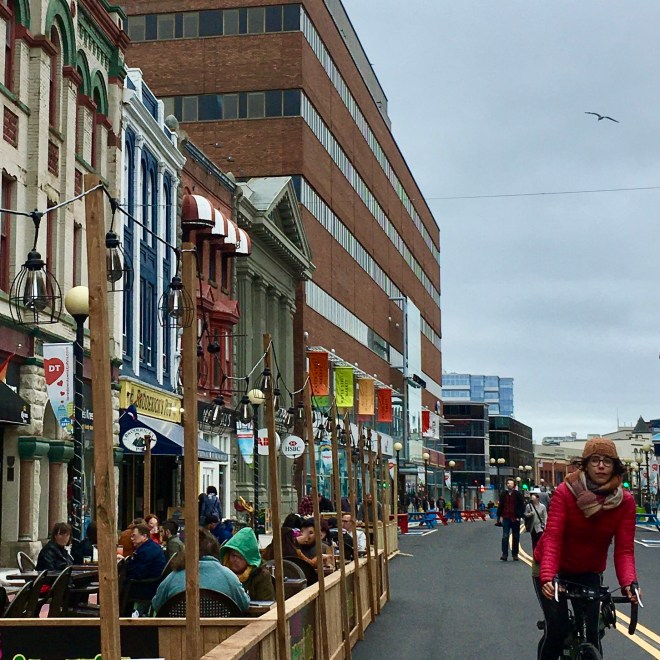
I rode west from where I live in the downtown so I started by riding through the fabulous new Water Street pedestrian mall. However, the weather has warmed up since my ride, the crowds are bigger and it may not be possible to ride through any more. In that case, you can either walk your bike and enjoy the scene or ride along Harbour Drive.
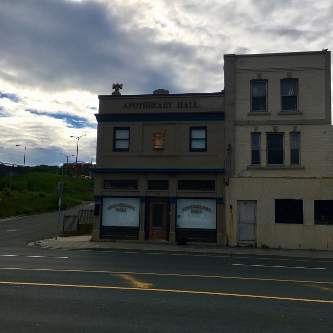
Past the fascinating time warp of the Apothecary Hall on Water St. west, formerly O’Mara’s Drugstore and now a museum of the history of pharmacy.
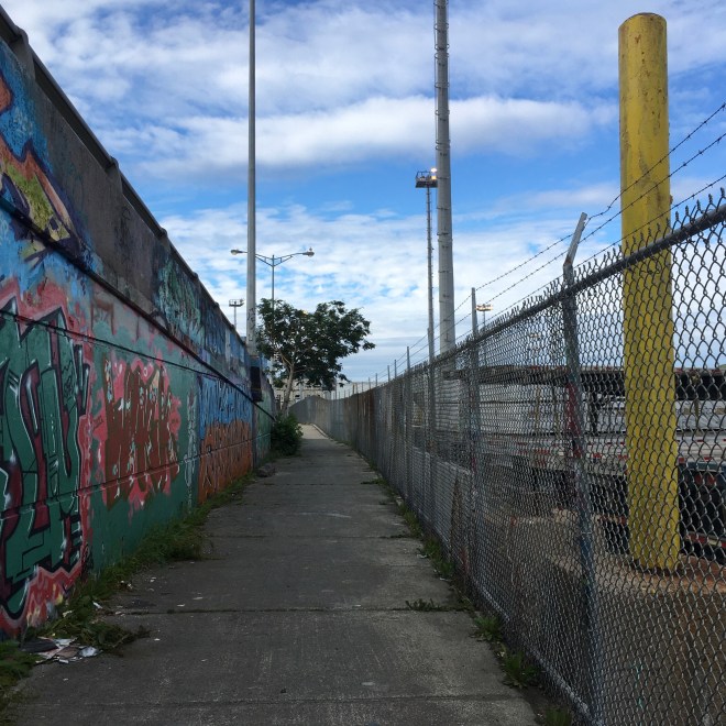
Cross the street and continue along the waterfront through some protected sidewalk. Lots of graffiti and litter as well as a variety of wild plants breaking through the concrete. Even with the litter, you immediately feel a marked reduction in stress when you get away from the busy vehicle traffic along that stretch.
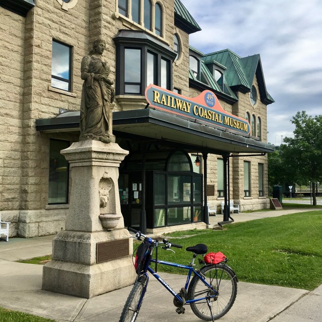
Enter the trail behind the old railway station, now a museum (actually, this whole stretch of Water St. is a bit of a time warp). The railway, sadly, is no more. In fact, this trail follows the railway bed from here right across the island of Newfoundland. The statue is The Maid of Industry, erected about 120 years ago by Charlie Henderson, a stonemason for the railway, in honour of his co-workers. See map and information here.

At the entrance to the trail is a little park with a more recent monument in honour of poet, author and activist Helen Fogwill Porter, who grew up nearby and writes about the Southside neighbourhood.
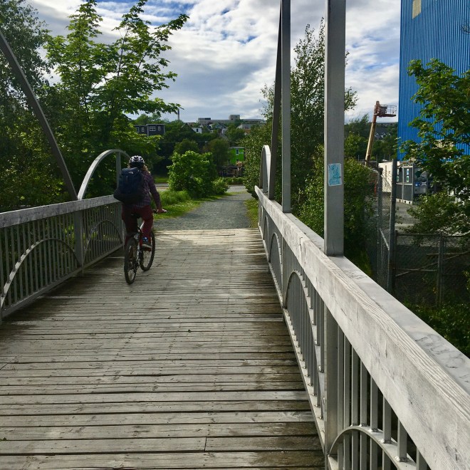
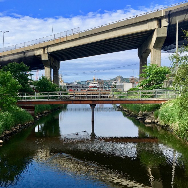
Bridge to the other side of the Waterford River and view from the bridge back towards the city and drydock.

A series of storyboards with a wealth of information about the flora and fauna along the river.
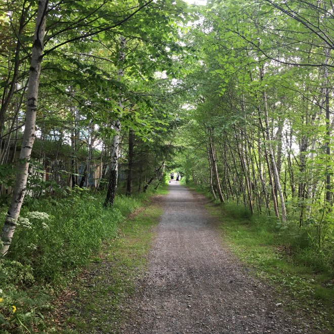
Along a hard packed dirt and lightly gravelled trail through trees…


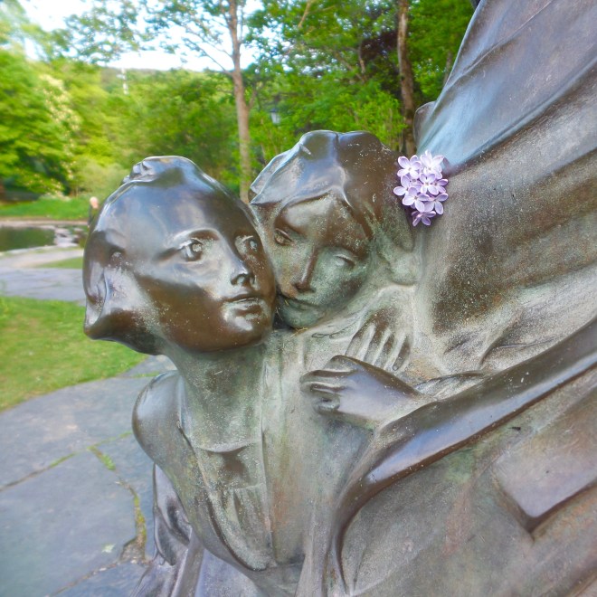
To Bowering Park and pause for a break by the duck pond and the Peter Pan statue (detail in this photo) erected in memory of Sir Edgar Bowering’s three year old granddaughter, Betty Munn, who died in the wreck of the SS Florizel in 1918.
The trail continues west all the way across the island but I stopped here.